Essential visitor information
- Place
- Lake Hallstatt Waterfront Walk
- Type
- Nearby attraction
- Region
- Hallstatt / Salzkammergut, Upper Austria, Austria
- Location
- Public Hallstätter See waterfront near Hallstatt
- Suggested time
- 30–90 minutes for a short shore walk
- Best for
- Landscape walkers and ferry photographers
Opening and admission
When can I visit?
Visiting arrangements depend on the operator and season. Consult the official provider or posted entrance notice before travel.
Tickets and costs
Public viewpoints and transport boats have different access rules and charges.
What makes this worth exploring?
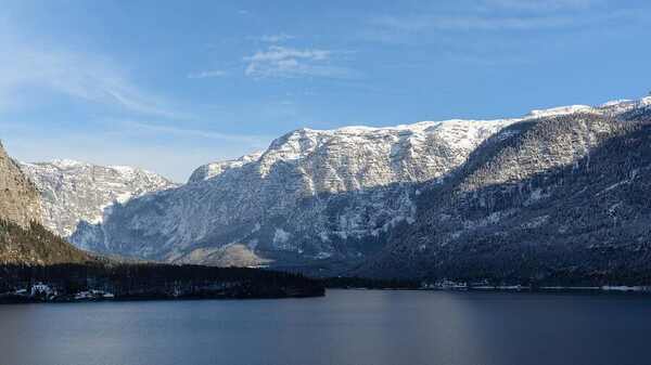
Look across the water to understand the steep slopes and the narrow strip of settlement along the shore.
Look for the meeting of waterside buildings, landing stages and dramatic mountain walls. The shoreline itself is the central landscape feature.
Suggested route and walking plan
Explore publicly accessible waterfront stretches around the village and connect them to the northern panorama.
- Choose a public lakeside access point
- Observe the village from shore
- Continue only on signed paths
- Return without entering private docks
Keep your return transport time in mind, especially for cross-lake ferry connections and mountain lifts.
How to get there
Public Hallstätter See waterfront near Hallstatt.
Public transport
Use the date-specific ÖBB rail or regional bus planner and check the final walking connection. If arriving at Hallstatt Bahnhof, factor in the lake ferry crossing.
Driving and parking
Follow designated visitor parking and local access signs. The historic centre and its viewpoints should be approached on permitted public paths, not by attempting to drive to a photograph location.
Before you go
Waterfront access is not continuous everywhere; obey barriers and keep away from private docks.
For museums, mountain lifts and managed attractions, check the operator’s current notices for admission, opening dates and accessibility. A search-map listing is useful for navigation but does not guarantee that an attraction is open or that a route is permitted.
Photography and observation tips
Use the shoreline as a leading line and watch reflections in calm conditions.
Look across the water to understand the steep slopes and the narrow strip of settlement along the shore.
Where to stay nearby
Staying in Hallstatt village keeps the historic centre close at hand but may involve restricted vehicle access and carrying luggage along narrow streets. Bad Goisern and Obertraun are alternative bases to compare for public transport connections, parking and mountain excursions. Choose accommodation by your departure timetable and mobility needs.
Frequently asked questions
What should I look for at Lake Hallstatt Waterfront Walk?
Look across the water to understand the steep slopes and the narrow strip of settlement along the shore.
How long should I allow?
30–90 minutes for a short shore walk; allow extra time for the journey and changing conditions.
How should I get there?
Explore publicly accessible waterfront stretches around the village and connect them to the northern panorama.
What should I check before leaving?
Waterfront access is not continuous everywhere; obey barriers and keep away from private docks.
Who looks after the site?
Hallstätter See is a lake with multiple shoreline communities and users, not a single ticketed attraction. Public pathways, boats and individual landing stages have different responsible authorities.