Essential visitor information
- Place
- Panoramic Viewpoint Address and Map
- Type
- Navigation
- Region
- Hallstatt / Salzkammergut, Upper Austria, Austria
- Location
- Gosaumühlstraße 67, 4830 Hallstatt, Austria
- Suggested time
- 10–20 minutes once you reach the viewpoint
- Best for
- Travellers needing an exact navigation target
Opening and admission
When can I visit?
For the public-street portions of this guide, follow the municipality’s current access and conduct notices. Individual venues along the route may keep separate hours.
Tickets and costs
Public village streets may be explored without a sightseeing ticket; any separately operated attraction has its own conditions.
What makes this worth exploring?
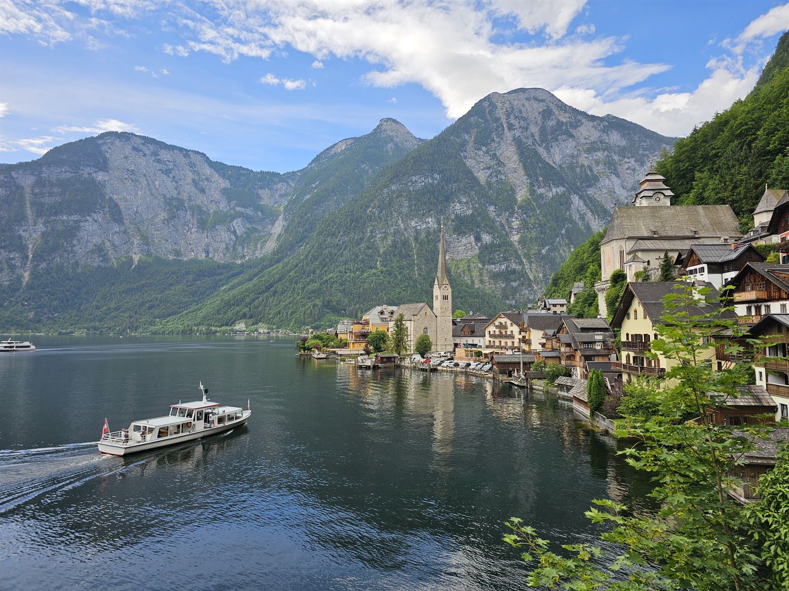
The lakeside viewpoint faces back toward central Hallstatt. Check the actual map pin before leaving because similarly named viewpoints refer to different places.
Observe the compact houses, steep roofs and tiered village streets arranged between the lake and mountain walls. The historic silhouette remains the key visual landmark.
Suggested route and walking plan
From central Hallstatt continue toward the northern edge of the village; choose the pedestrian approach indicated by current local signs.
- Open the supplied map pin
- Choose an authorised arrival point
- Walk to the northern lakeside viewpoint
- Check the location before continuing
Keep your return transport time in mind, especially for cross-lake ferry connections and mountain lifts.
How to get there
Gosaumühlstraße 67, 4830 Hallstatt, Austria.
Public transport
Use the date-specific ÖBB rail or regional bus planner and check the final walking connection. If arriving at Hallstatt Bahnhof, factor in the lake ferry crossing.
Driving and parking
Follow designated visitor parking and local access signs. The historic centre and its viewpoints should be approached on permitted public paths, not by attempting to drive to a photograph location.
Before you go
The address is a navigation aid, not a promise of vehicle access or parking at the camera position.
For museums, mountain lifts and managed attractions, check the operator’s current notices for admission, opening dates and accessibility. A search-map listing is useful for navigation but does not guarantee that an attraction is open or that a route is permitted.
Photography and observation tips
Compare the map pin and real streetscape before choosing a safe stopping position.
The lakeside viewpoint faces back toward central Hallstatt. Check the actual map pin before leaving because similarly named viewpoints refer to different places.
Where to stay nearby
Staying in Hallstatt village keeps the historic centre close at hand but may involve restricted vehicle access and carrying luggage along narrow streets. Bad Goisern and Obertraun are alternative bases to compare for public transport connections, parking and mountain excursions. Choose accommodation by your departure timetable and mobility needs.
Frequently asked questions
What should I look for at Panoramic Viewpoint Address and Map?
The lakeside viewpoint faces back toward central Hallstatt. Check the actual map pin before leaving because similarly named viewpoints refer to different places.
How long should I allow?
10–20 minutes once you reach the viewpoint; allow extra time for the journey and changing conditions.
How should I get there?
From central Hallstatt continue toward the northern edge of the village; choose the pedestrian approach indicated by current local signs.
What should I check before leaving?
The address is a navigation aid, not a promise of vehicle access or parking at the camera position.
Who looks after the site?
The Panoramic Viewpoint is a public streetside viewing location in Hallstatt, not a separately ticketed museum. The municipality governs local public-space rules; adjoining homes and premises remain privately or independently managed.